I’ve been studying the science behind the scenery of parts of the American West since the summer of 1983. My interest grew out of gawking at atlases and encyclopedias in my basement on Maine Street in Enid, Oklahoma and taking the occasional family trip to Colorado. My early interest in maps paid-off mightily when I found Bellingham, Washington, on one. I left Oklahoma with minimal regrets in August of 1983 to attend college in Bellingham. The spectacular scenery and topography of northwest Washington is a lot for anyone to absorb, especially a kid from the flattest part of Oklahoma. My cultural and scientific awakening came on full-force after moving to the Pacific Northwest. I had left home with no clue about what I would do with myself and with a litany of preconceptions about the world that quickly proved to be laughably, even horribly, wrong.
I earned two degrees from Western Washington University in 1989: BA in Geography (w/cartography minor) and BS in Environmental Geology; and two degrees from the University of Arizona: MS in Geosciences (1991); and PhD in Geosciences (1996). I have since become a professional geologic mapper specializing in surficial geology and fluvial landscape evolution. My education was a circuitous route that ends up looking like a good plan.
My graduate studies in geosciences at the University of Arizona were guided by Victor Baker, Bill Bull, Katherine Hirschboeck, and Phil Pearthree. My research focused on late Holocene flood stratigraphy of rivers and washes in central and western Arizona; the hydroclimatology of large floods in Arizona; and documenting prehistorical and historical channel changes on rivers in the state. I collected beer cans as a kid and worked on my dad’s beer-delivery trucks in my teens. In one of my first papers about desert floods, I described using beer cans to reconstruct flood chronologies in seemingly desolate desert areas.
During graduate school, I worked at the Arizona Geological Survey with a variety of talented geologists. My work there focused on surficial geologic mapping projects, geological flood (‘paleoflood’) studies, and historical river channel and floodplain evolution of rivers, washes, and alluvial fans in Arizona. The AZGS was a fantastic place to work. I did a lot of field work while a student, and the warm and rugged deserts of western Arizona entranced me.
I did post-doctoral studies (1996-1998) at the Desert Research Institute in Reno, NV with Stephen Wells. Opportunities at DRI sent me to Italy, Argentina,Brazil, and Israel; but research during my DRI tenure was focused mostly on finding and studying the Holocene stratigraphic records of flooding on rivers in deserts of Nevada, Arizona, and Oregon. It was a great couple of years, and I am forever indebted to those who made it possible.
I was hired as a research geologist / associate professor at the Nevada Bureau of Mines and Geology (NBMG) in 1998. NBMG is part of the University of Nevada, Reno (UNR), and I became a tenured professor there in 2002. A tenured geologic mapper and part-time teacher / field camp instructor? A rare opportunity indeed. I still struggle to not excessively rue the day that I walked away from that near-optimal setup. I had my reasons at the time. During 12 years at NMBG, I became a professional geologic mapper. I had the luxury to explore the western deserts of America with geologic and cartographic intent and began to think about landscape evolution over broader scopes of space and time. I made lots of maps of interesting areas while at NBMG and worked with a group of talented geologists and cartographers. I also worked to engage students through collaboration and instruction in geomorphology, landscape evolution, and geologic mapping. On 8 occasions Between 1998 and 2010, I taught a 7-10 day session on surficial geologic mapping for the UNR summer geology field camp. During those times, I learned how to express my fascination with geology to a range of receptive students. I am proud to have explained to many burgeoning, talented geologists that it is nothing short of geoscientific treason to map all Quaternary surficial units as one unit or to refer to them as just various manifestations of 'dirt'. They are sedimentary rocks in the making, of course, so the ‘just dirt’ idea is high-grade bullshit.
During the NBMG years, I authored or co-authored more than 20 geologic maps of parts of Nevada and surrounding states; served as lead editor of a book on Paleoflood Hydrology; authored or co-authored 20 peer-reviewed articles and book chapters; and authored or co-authored more than ~50 professional talks. I have received 'outstanding paper awards' for 2 peer-reviewed, senior-authored papers that were based on work initiated at NBMG. I have many fond memories of the academic and creative flexibility, salary, and leave opportunities I was allowed there and I hold the institution in very high esteem.
In the late Summer of 2010, I left NBMG for a rare and permanent mapping position with the USGS in Flagstaff, Arizona. I had run out of Colorado River to map from my location in Nevada and this new gig allowed for a broader berth for field work in my favorite parts of the country. It was a good and impeccably timed professional move for me for a variety of reasons. Foremost among them is that it was a good change for my family. For us, the move provided an increase in quality of life. Flagstaff is a nice place to live. Always remember that life, dear reader, is full of choices and compromises. I took a big pay cut, abandoned a tenured position at a good university, and downgraded my benefit package to a cringe-able extent. But hey, I moved back to Arizona to live in the mountains and drastically reduced the danger and length of bike-commutes to work.
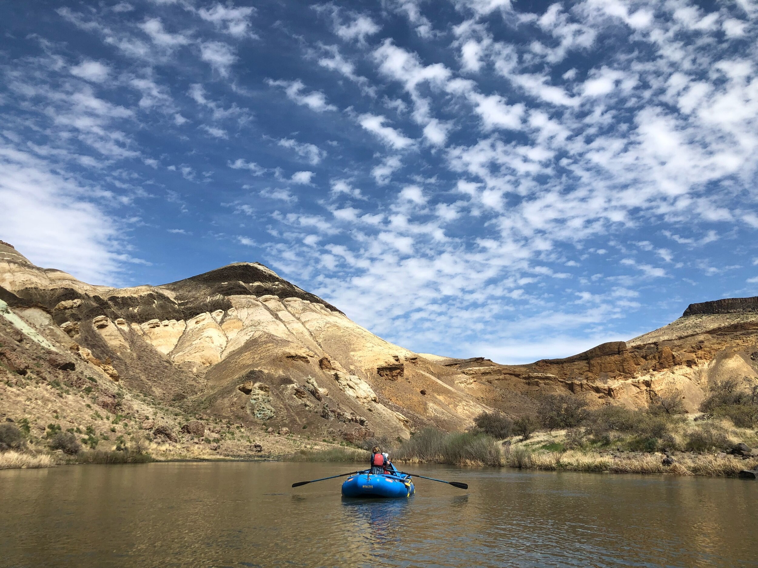
I am currently co-leading a major mapping project along the lower Colorado River in Arizona, California, and Nevada. We have an appallingly small, yet excellent mapping/gis team. The project began a new phase toward more regional scale mapping of the Colorado River system in October 2018. I am also currently attempting to wrap-up a major geologic mapping project on the truly fascinating Owyhee River in southeastern Oregon and revitalizing my early mapping efforts in the Verde Valley, Arizona.
Why I map
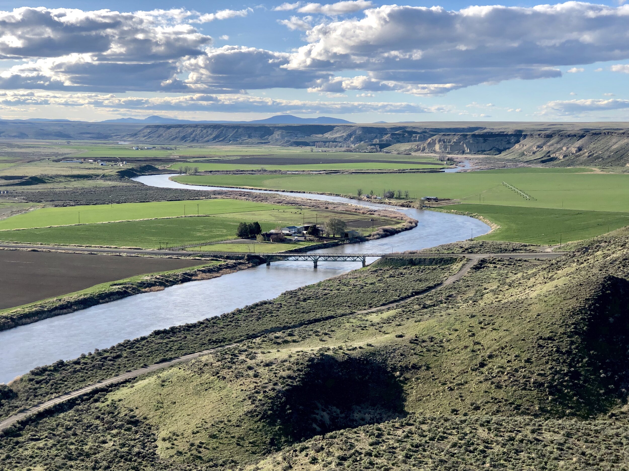
I am proud to be a professional geologic mapper. Essentially, I and my colleagues are professional explorers. I use mapping to delineate, measure, and summarize the geologic effects, timing, and signatures of surface processes that drive landscape evolution…thus, the science of scenery. An emphasis and reliance on mapping large swaths of ground requires consideration of geologic processes over a broad range of spatial and temporal scales. That is the most informative part of geologic mapping. Sure, great exposures are nice and can spawn numerous niche publications that comfortably pad a CV, but maps tell the larger story. Since 1990, I have accrued extensive field experience in diverse geologic settings in desert areas of Nevada, Arizona, Oregon, and California through numerous mapping projects on the Verde, Bill Williams, Truckee, Walker, Humboldt, Carson, Colorado, and Owyhee Rivers. Most of these efforts have focused on geologic records of landscape evolution as driven by combinations of climatic change and variability; tectonic activity; landslides; catastrophic floods; and volcanism.
My early career focused on using geologic information and reasoning to better understand flood hazards in desert areas. The work included stratigraphic studies, hydraulic modeling, and geologic mapping. I researched the paleoflood histories of canyons and floodplains of rivers and ephemeral streams in the West to better understand variations in flood magnitude and frequency over long, but socially relevant time frames (100s to 1000s of years). My research on the direct relation between the surficial geology of desert piedmonts and alluvial fan flood hazards has contributed to improved perspectives on floodplain management and regulation in desert areas. I wrote a paper on alluvial fan flood hazards in Laughlin, Nevada showing that regulatory methods for flood hazard assessments on fans can be problematic. This paper was recognized by the American Water Resources Association as the outstanding paper of the year for 2005. My last major flood-related study was in Ivanpah Valley, Nevada.
Recent work in Geologic Mapping and Landscape Evolution
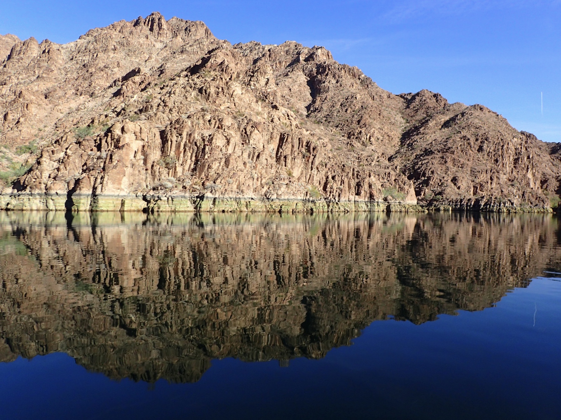
I have been working on unraveling geologic events in the history of the lower Colorado River [the part downstream from the Grand Canyon] for 20 years now. The most significant outcome of these efforts has, by far, been the discovery of evidence suggesting that the evolution of much, if not all, of the river's course below the Grand Canyon was formed by a series spilling-lakes between 4.8 and ~5.3 Million years ago. The key geologic deposits supporting this idea lay in the desert on the outskirts of Laughlin, Nevada and Bullhead City, Arizona. The day I found the flood deposits that 'clinched' the deal was a good one. In a completely unexpected turn of events in mid-2013, my 2008 paper (written with Phil Pearthree and Mike Perkins) describing this discovery received the Kirk Bryan Award for Research Excellence from the Quaternary Geology and Geomorphology Division of the Geological Society of America. This was the truly greatest honor of recognition that I expect to get in my professional life. Now it is a waiting game while my colleagues try in earnest to disassemble parts of the story while I roam around the desert finding more outcrops. Maybe they’ll get an award for doing so, who knows? Meanwhile, I keep on mapping in the river corridor and sharing my findings with them. Science is a collaborative process drawn from many individual efforts.


I used to spend a lot of time mapping along the rivers and lakes of Nevada, the modern ones and their ancient forebears. I remain awestruck by how rapidly environmental changes occur and how rapidly and dramatically fluvial, aeolian, and lacustrine systems respond to them. No matter how many times I see, describe, and map the evidence, I am amazed like a child by what has transpired. Sometimes those changes have occurred over thousands to millions of years, other times over single years to decades. I am obsessed with finding and pondering the stratigraphic and geomorphic evidence attesting to these changes, their magnitudes, and their rates. That is part of the occasional bouts of sheer joy that field work can bring. Seriously, what beats finding and pondering the implications of a boulder larger than your living room that blasted out of the mouth of a steep canyon only 500 years ago?
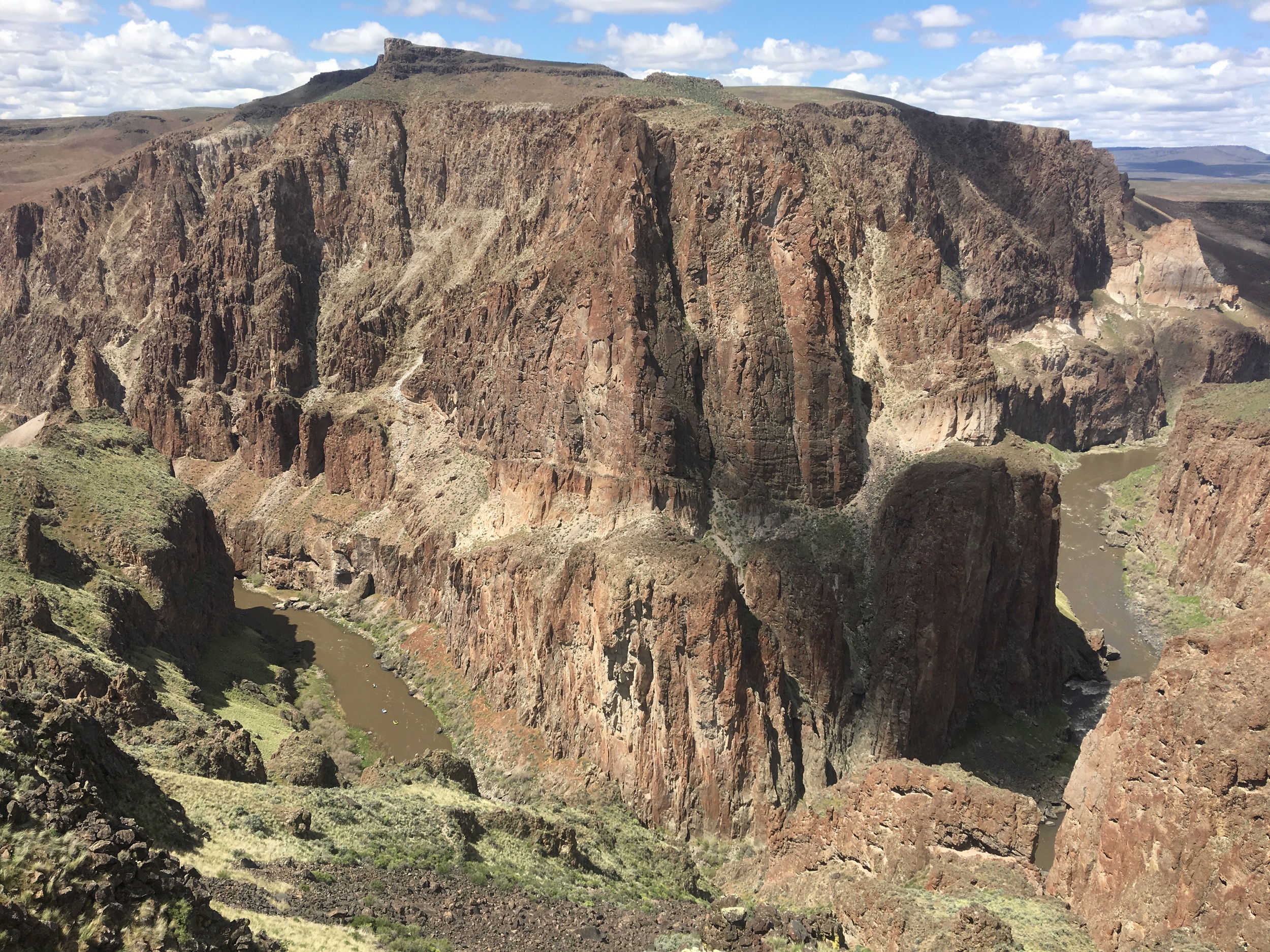
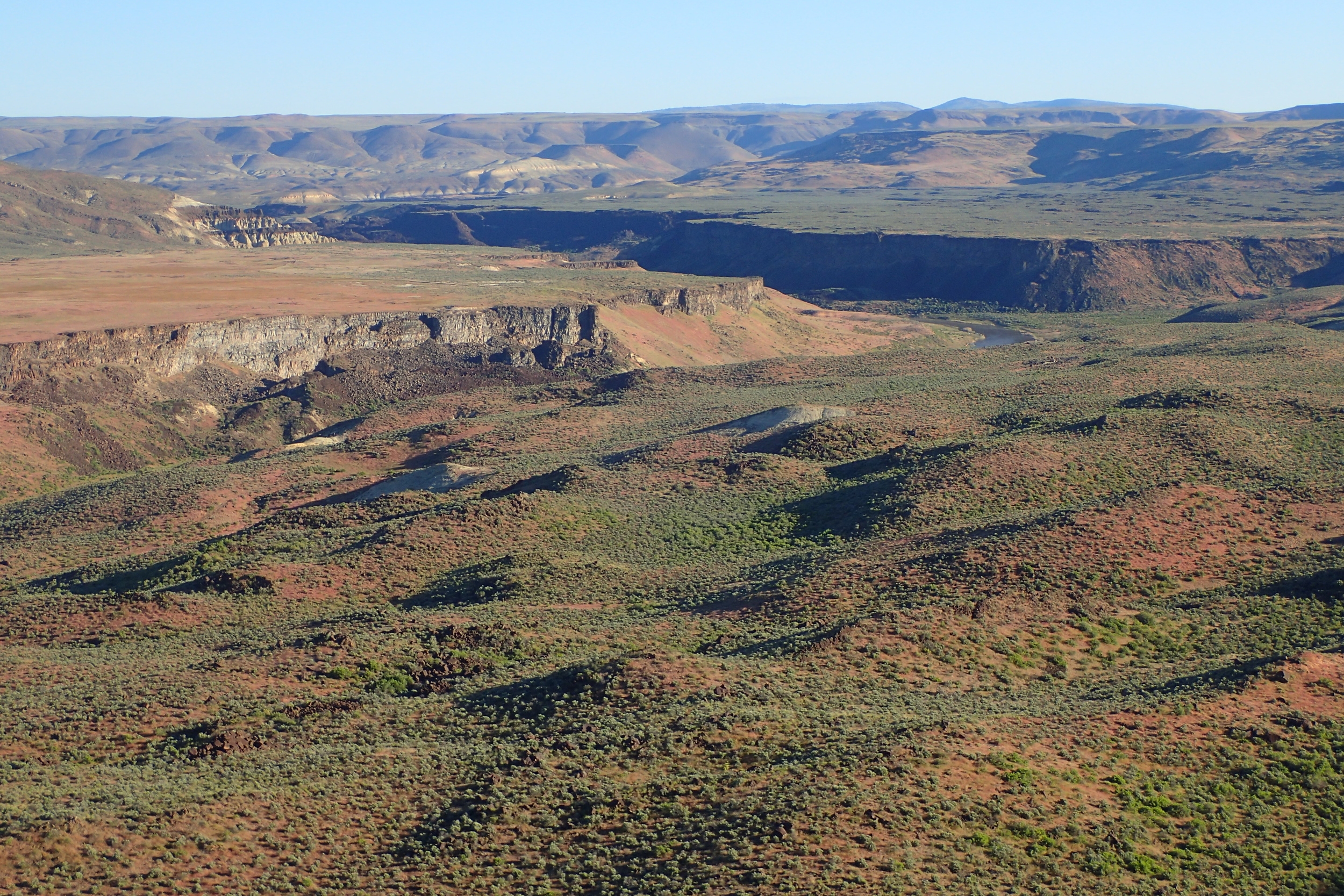
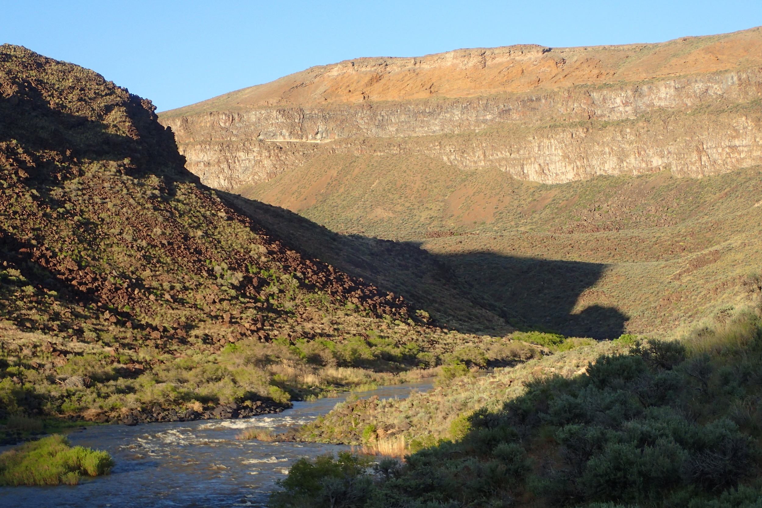
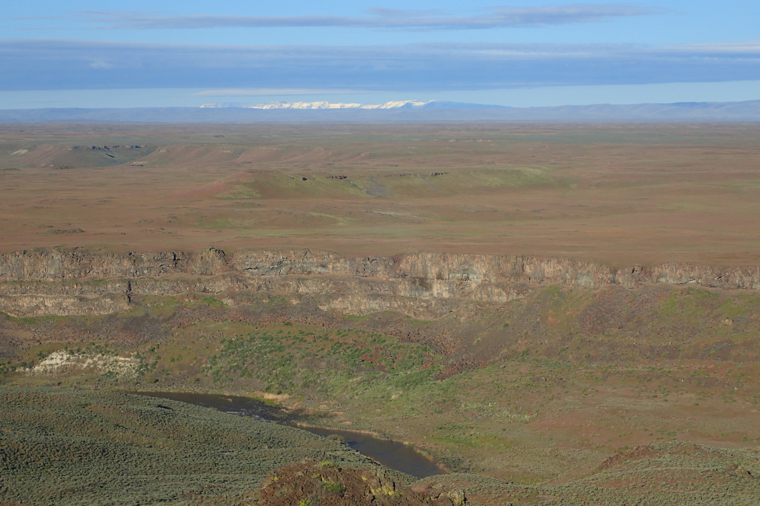
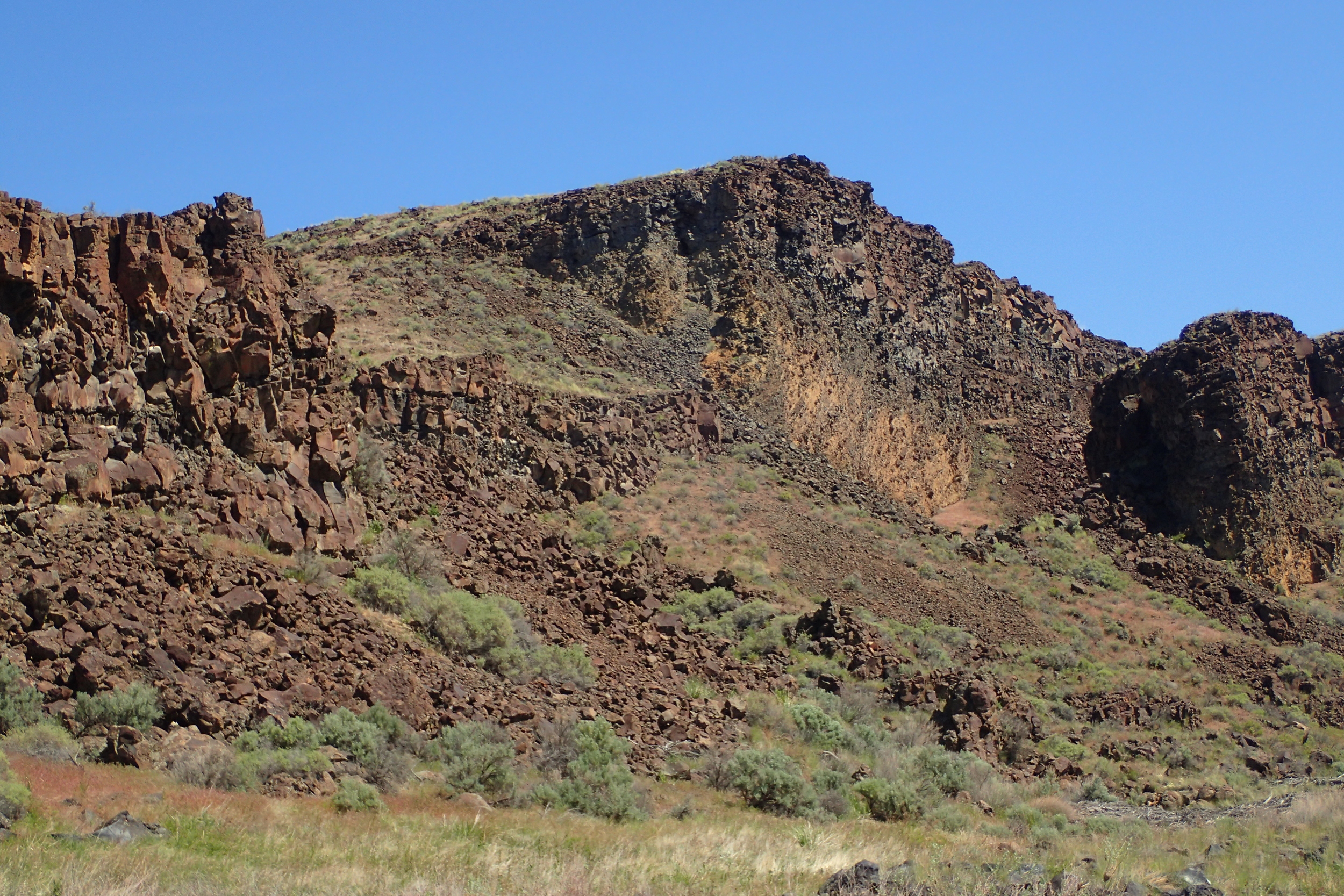
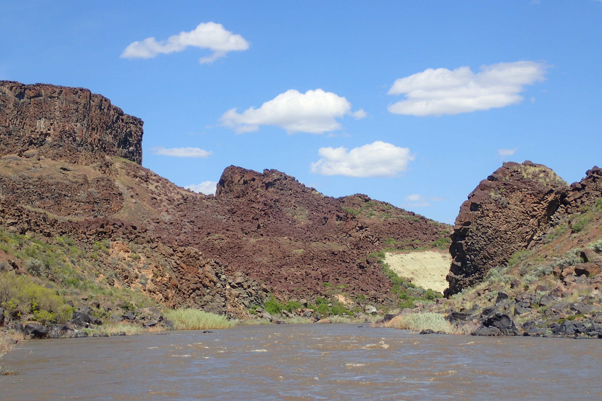
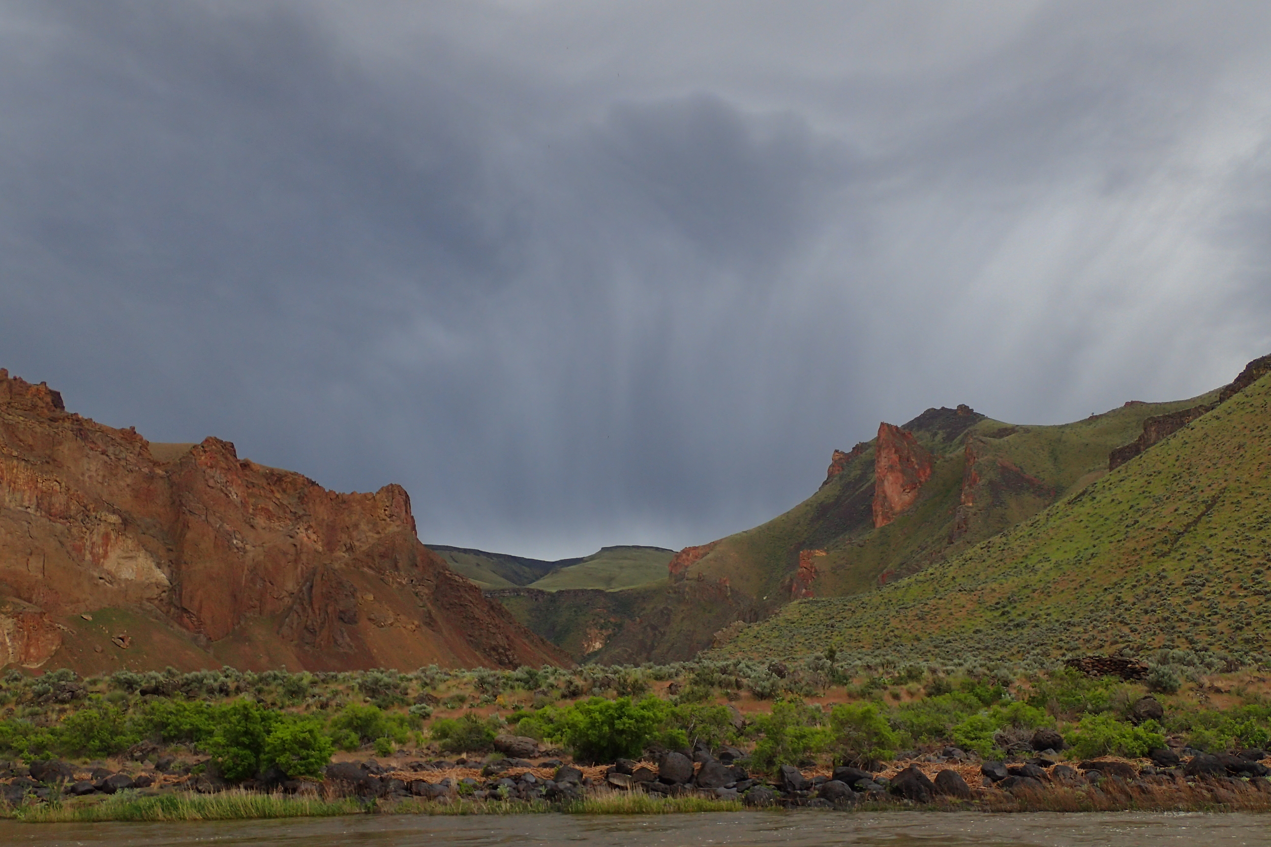
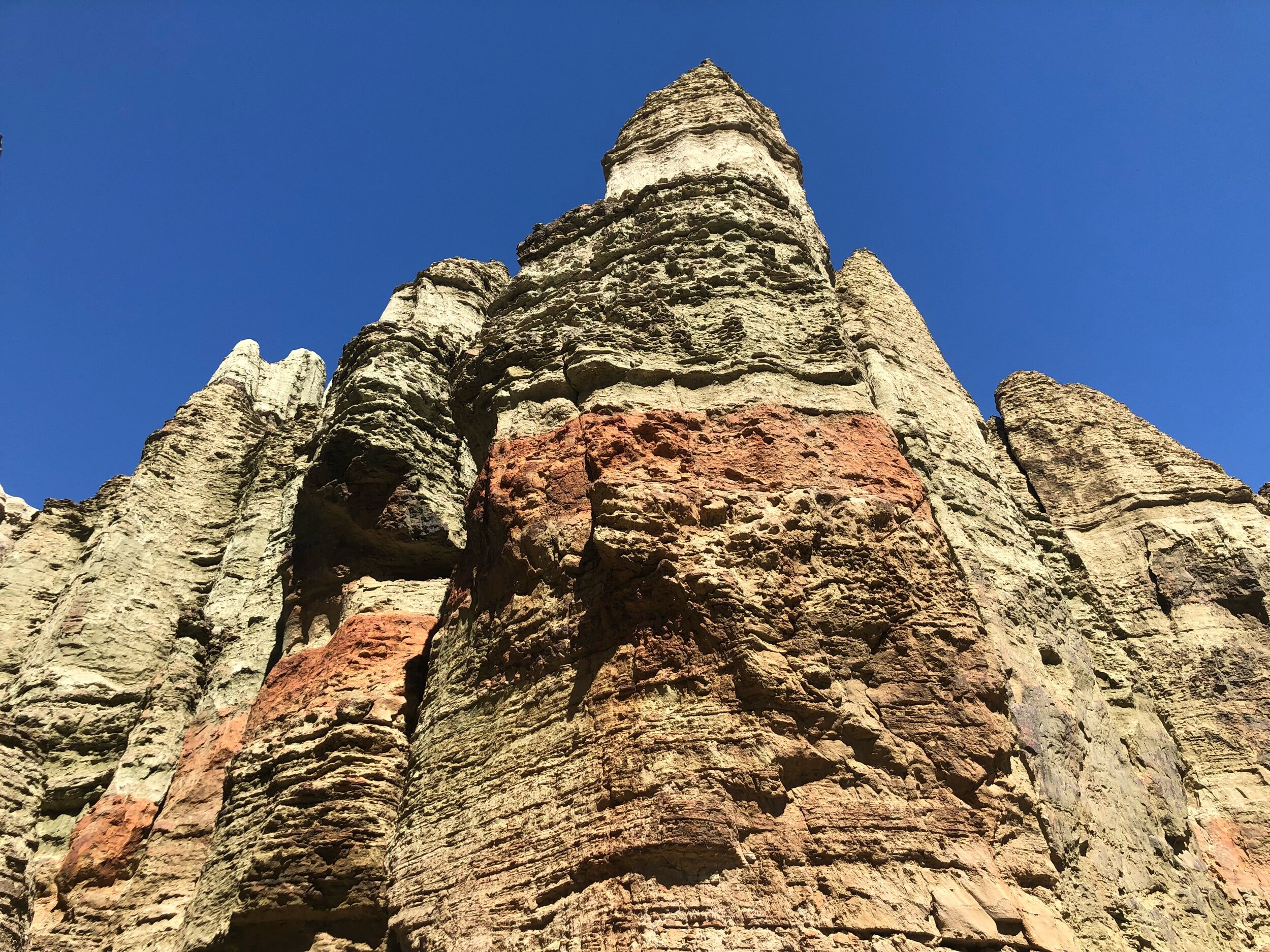
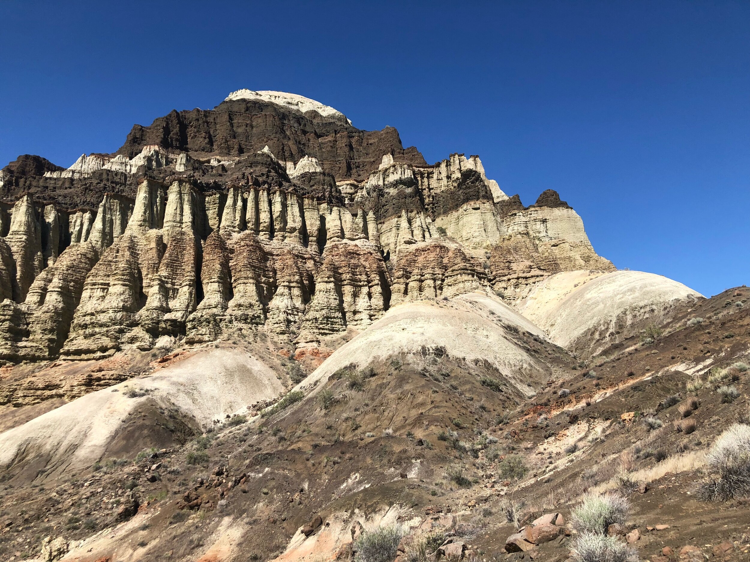
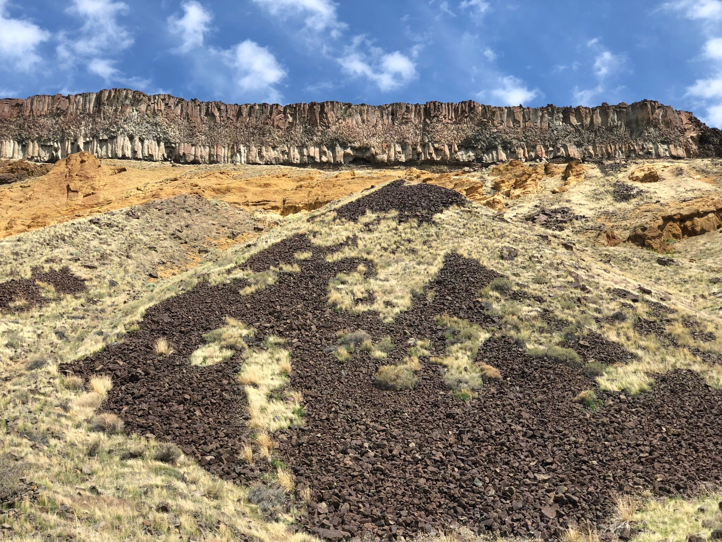
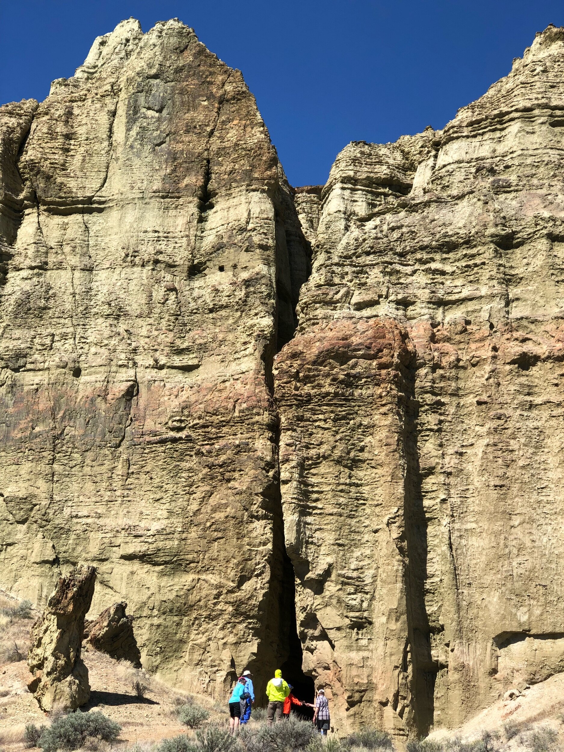
My recent work on the Owyhee River in southeast Oregon added an entirely new dimension to my understanding of the way rivers work. It involves unraveling the evolution of a desert river that is periodically plagued by geologically instantaneous infusions of voluminous canyon-choking lava flows. The lava flows construct massive dams that span valleys, extend tens of kilometers along the river, and last for as many as up to ten thousands of years. This volcanic circumstance is quite an affront to a river, and the mappable geologic consequences are simply mind-boggling. When the Owyhee isn't being clogged and repaved with lava, it is being pummeled along its course by huge landslides. The landslides have less of a lasting impact on the channel than the lava flows, but they constitute a notable, local sediment pulse and a temporary damming mechanism that the river often resolves through catastrophic failure and flooding. In addition to lava dams and landslides, the Owyhee has also had to convey huge flood(s) from pluvial lake overflow out of the Alvord Desert at the foot of Steens Mountain. Spoiler alert: the river always wins, and these obstacles, though seemingly gargantuan, are mere nuisances in the bigger scheme of time.
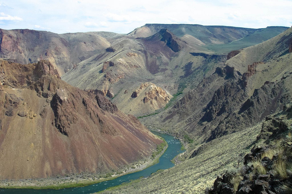
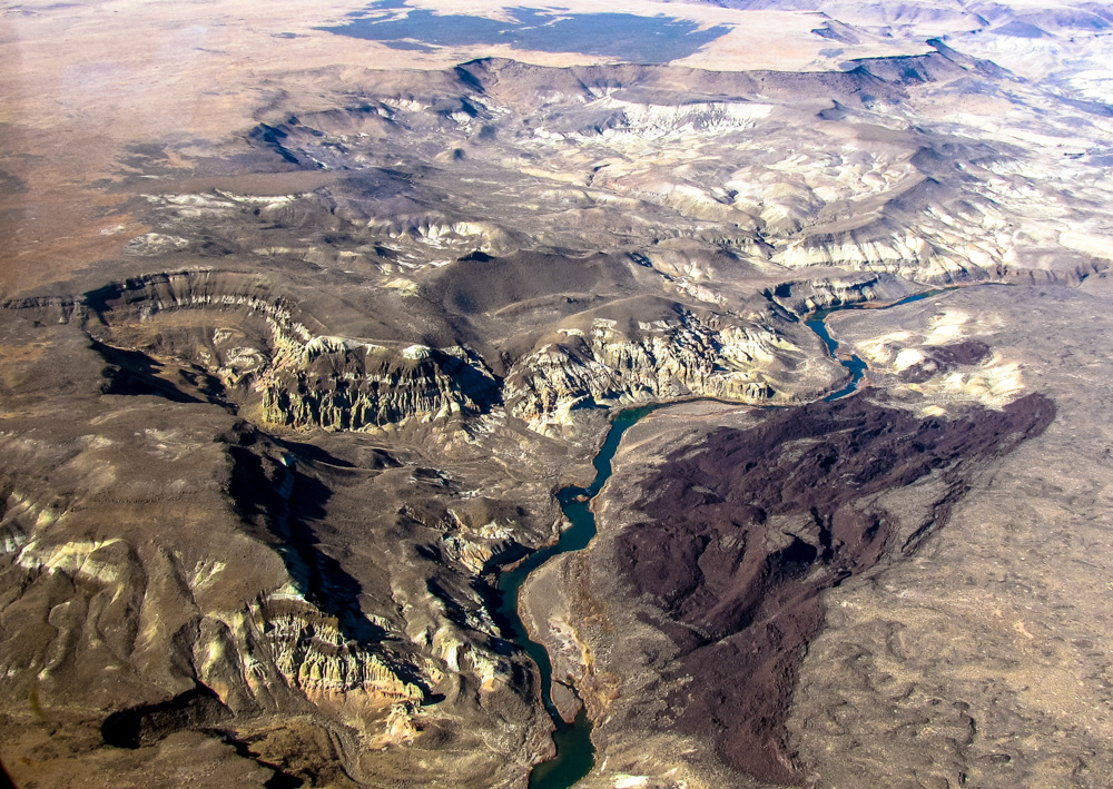
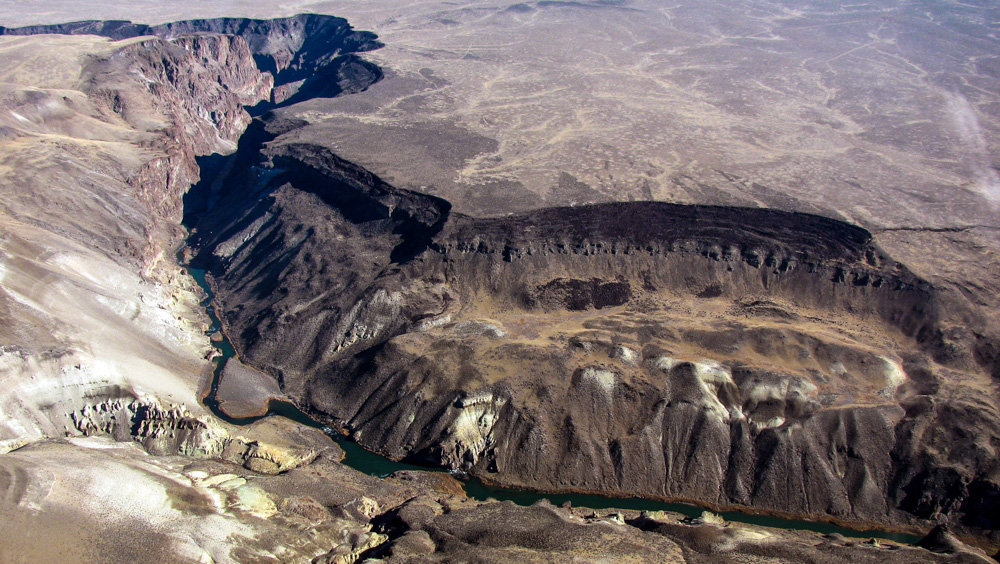
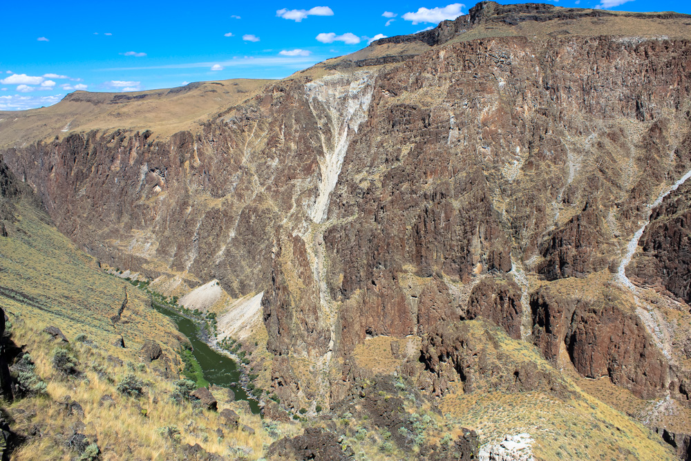
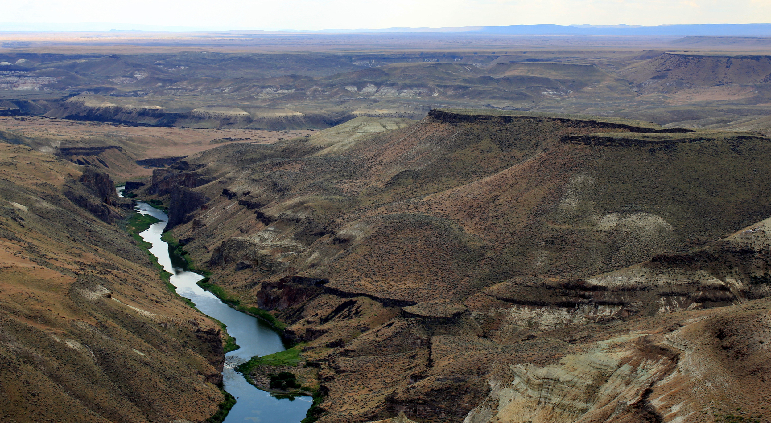
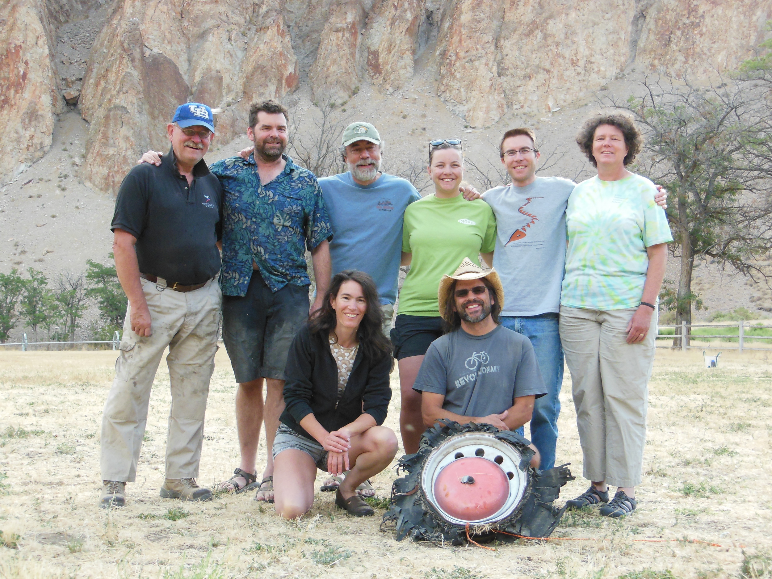
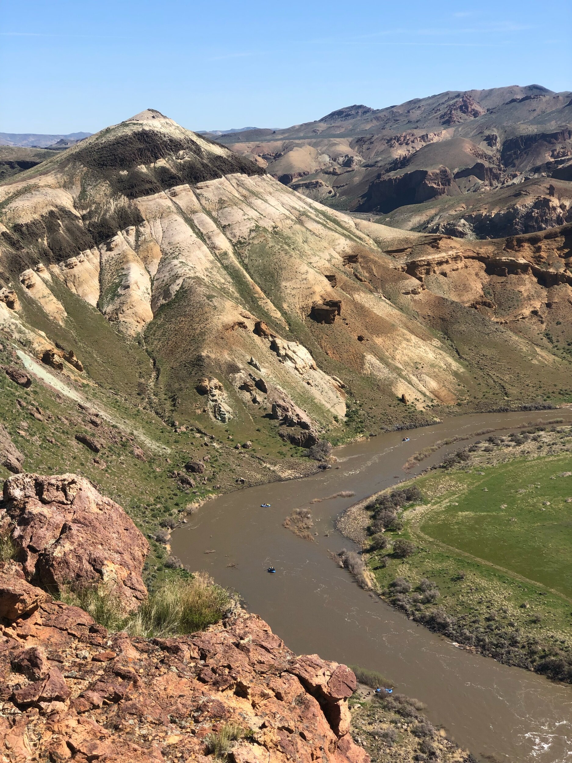
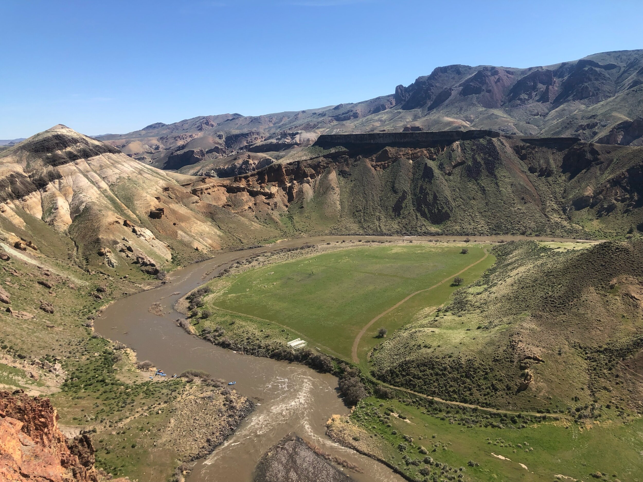
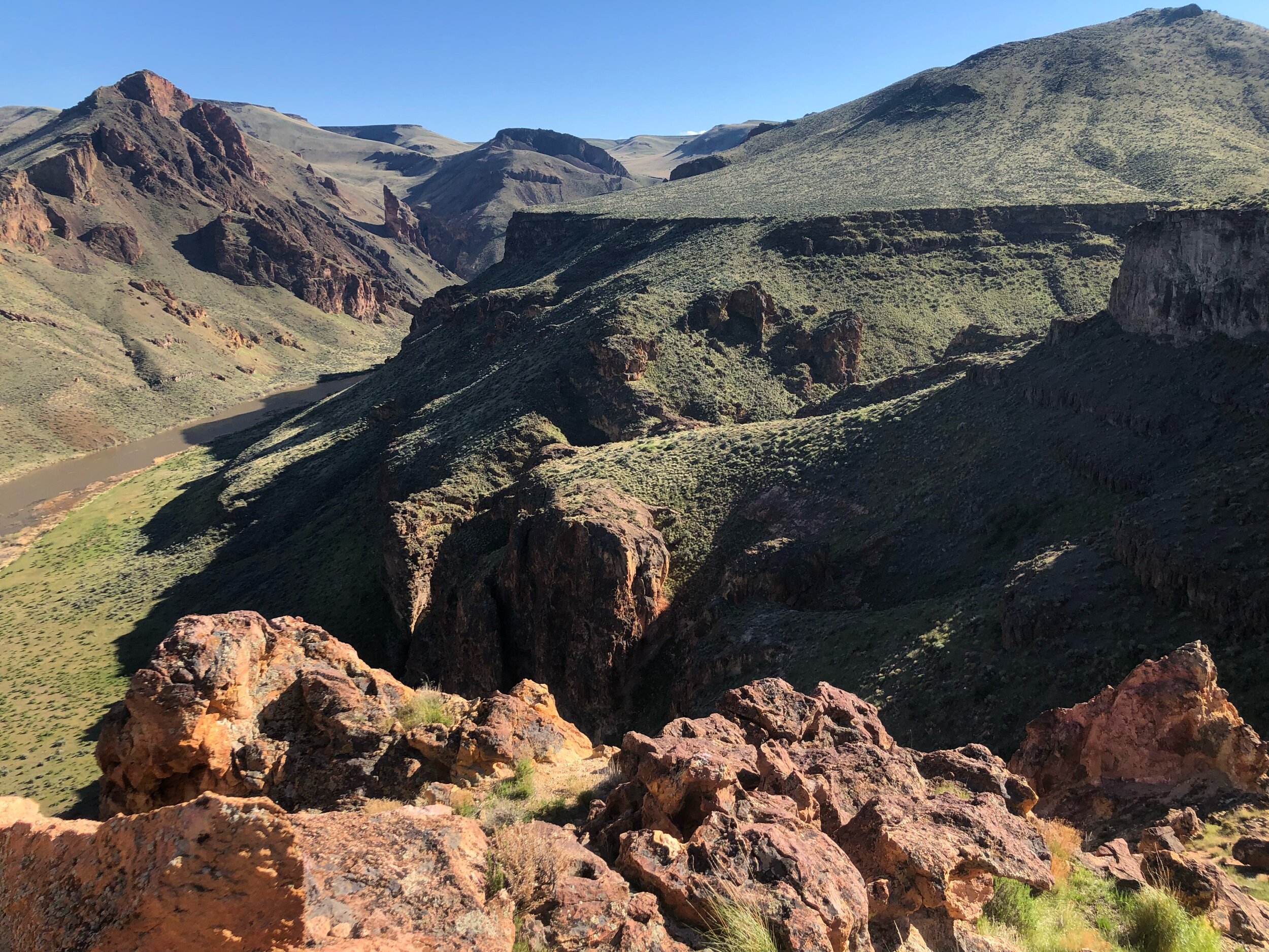
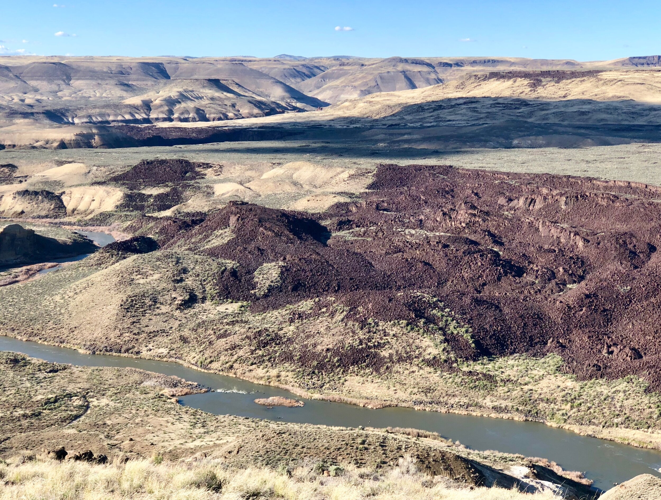
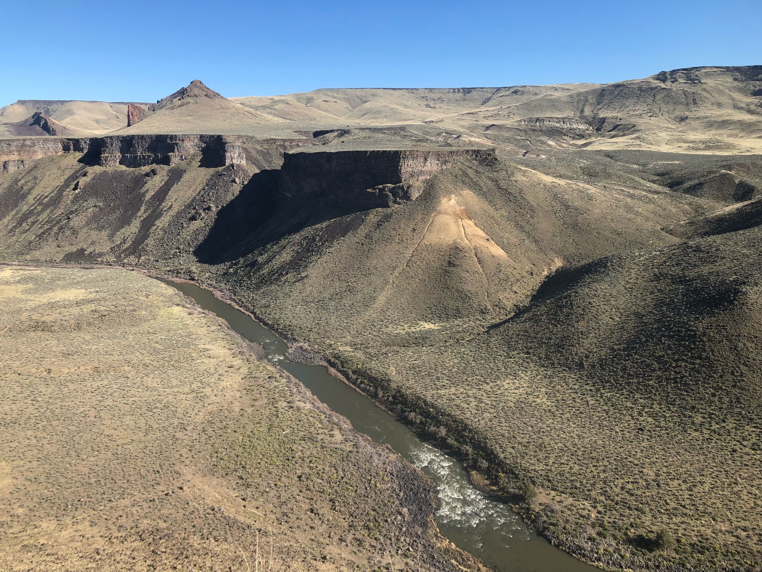
I have worked on the Owyhee with a great research team between 2001 and 2012, with a major burst of research between 2007 and 2012 and then again between 2016 and now. We summarized key aspects of our Owyhee River work in a paper in 2012, but I am still working hard to complete one of the greatest maps of my career in my spare time. It will happen in 2021, right?
Other Professional Interests and Skills
I am adequately self-sufficient in GIS for generating geologic maps and am always trying to improve my skills in this arena within reason. Since GIS can devolve into a full-time job, my intermediate skill-set and my available support tends to be almost adequate to balance science with GIS and cartography. However, spending much of my time mapping at home on my computer during the pandemic and associated catastrophic national failure in 2020, I have upped my skills to a notable extent.
In the previous decade, I became interested in the use of new digital devices and methods for improving workflow in the field and the office. I also spent time pursuing social media applications as platforms for disseminating information about these methods and devices to my colleagues and students. In this vein, I once maintained a series of geologically themed Blogs (archived on this site). I remain a decreasingly visible advocate of adopting new technology. Much of what I and a select few other geologists advocated for so strongly between 2007 and 2010 has gained considerable traction in the field. Most of the things I was interested in back then now pale in the face of modern technology. This development was inevitable, but it was fun to surf the early waves instead of being crushed by them. I gave up on blogging and pursuing digital nirvana in the field when my job choice, family life, grew more complex over time. Also, much of it became far, far less fun and interesting with my change in employment in 2010. Nonetheless, in another fortuitous turn, I and two highly capable colleagues published a chapter in a recent (2013) book: Rethinking the Fabric of Geology. It was published in 2013 in celebration of the 125th Anniversary of the Geological Society of America. The paper is called: Overcoming the Momentum of Anachronism--American Geologic Mapping in a Twenty-First Century World. Looking back, it is amazing that it got published. Writing it allowed me to produce a personally satisfying (selfish?) coda to the snarky but informative commentary that I tried to develop in my pre-USGS life. Momentum of anachronism? That preposterous term grew out of numerous, persistent spates of professional frustration that have incrementally crushed my soul and some of my dreams since my career transition in 2010. So far the paper has received starkly polarized reviews, which is the obvious outcome for me. I stand behind the ideas that it presents, particularly as they continually evolve into prescient ones. Even the detractors have to admit that.